Creating the route for a new gravel bikepacking event is an incredible amount of work, particularly if you really want it to be perfect. Olly gets an invite to join event organiser Rich Rothwell as he researched route options for his new event, The Land Between, the inaugural version of which will take place in August this year.
“If it’s OK with you, I’ll meet you in Alwinton and I’ll ride there from home as I need to get some extra miles in” said the message from Rich Rothwell. I did some speedy web research and calculated that his ride just to get to the meet-up point was more than 40 km. That tells you a lot about him and his attitude to pretty much everything – if you’re going to do something, do it properly. Our plan for the day was to ride the northernmost section of the route for The Land Between event to make sure it was appropriate. The full route is still being finalised, but will be somewhere around 480 - 563 km (300 – 350 miles) and will take participants roughly around the perimeter of the county of Northumberland.
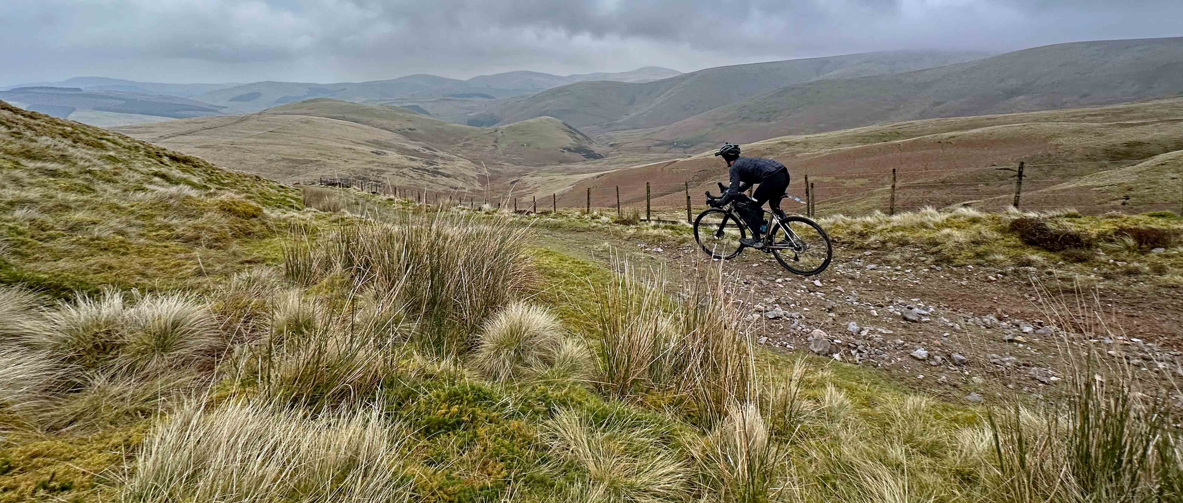
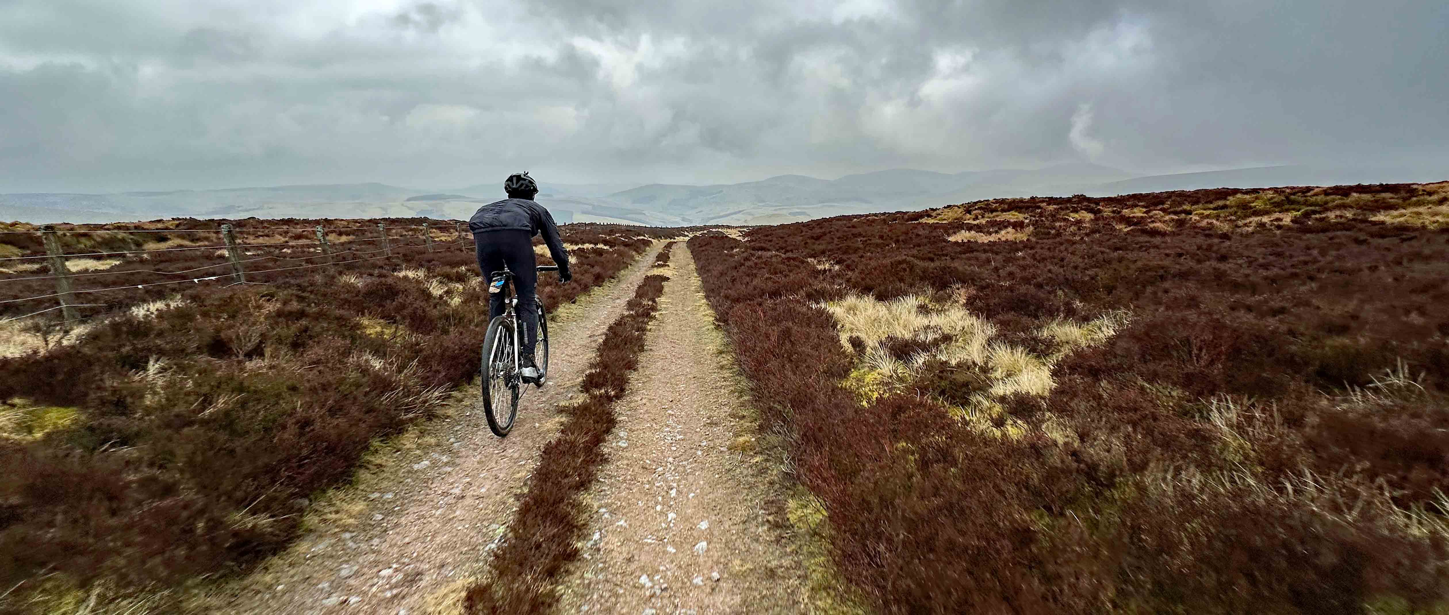
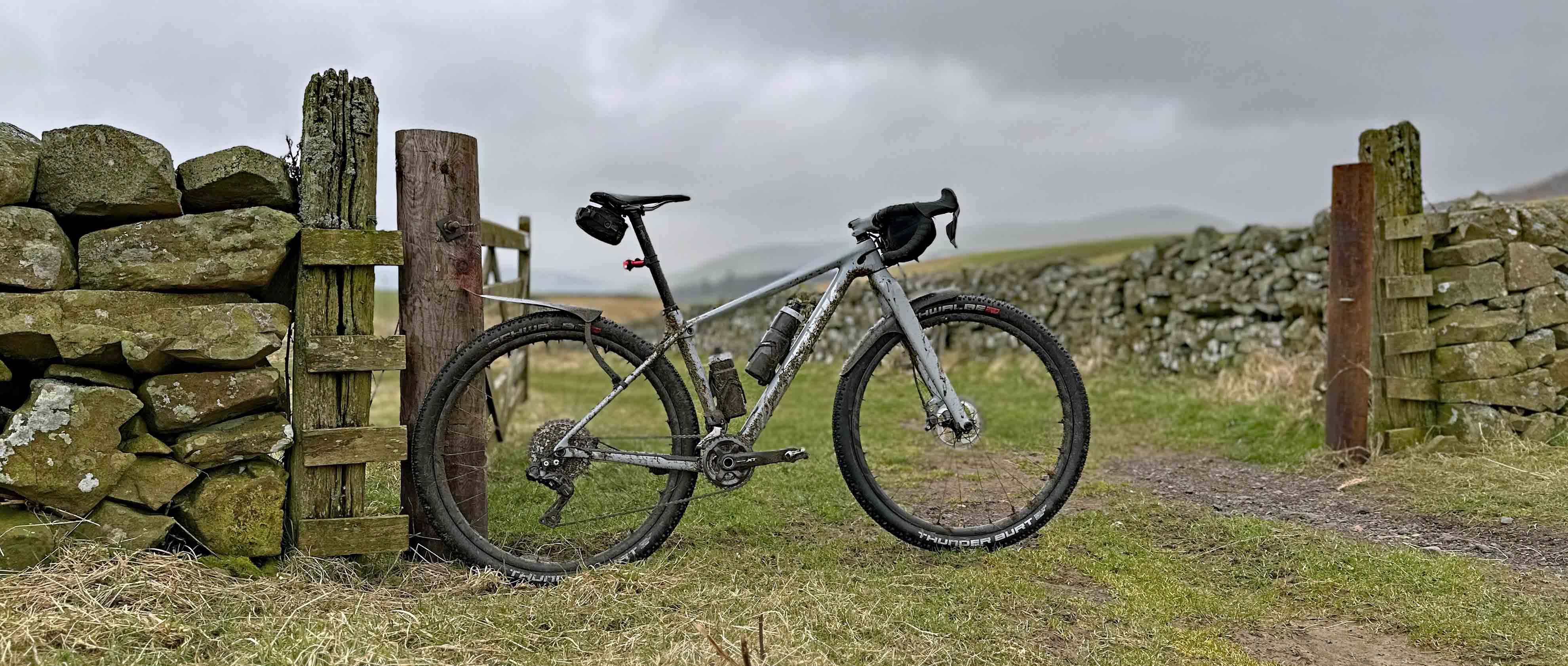
“I wanted to make the first climb a good challenge, but not so hard that it breaks people” said Rich as we winched our way up the initial 10% gradient. Our track was an archetypal northern gravel road – vehicle width, spectacular views (even with the overcast conditions), but very variable surface conditions with a good sprinkling of loose rock on top of the hardpacked gravel. This is not the champagne gravel riding you might find in the south, but the rugged, weather-hardened northern cousin. Until only a week earlier, this route had been completely off the edge of my mental map, but then in complete coincidence, I’d happened to spend a few days staying in a holiday cottage close by. “I reckon even a lot of riders from Newcastle [around an hour’s drive to the south] won’t know this” said Rich and he was absolutely right. Despite living relatively close for more than a decade, the whole of the first climb was new to me and it made a spectacular start to both our day ride and to the full event route.
The far north of Northumberland is properly remote and wild feeling. Apocryphally there are more sheep than people in the county and the overarching feeling as we climbed was of peace and solitude. There was no noise other than the rasp of our breathing (well, my breathing anyway – Rich apparently doesn’t need to breathe no matter how sustained the climbing is…), the crunch of gravel under our tyres and the plaintive mewing of a pair of buzzards which wheeled overhead. With the hilly border country to the north of the region enmeshed in a web of bridleways and byways, many of which date back to the time of the Roman occupation, it’s a perfect area of gravel riding, but one which many UK riders, let alone overseas visitors, will have never sampled.
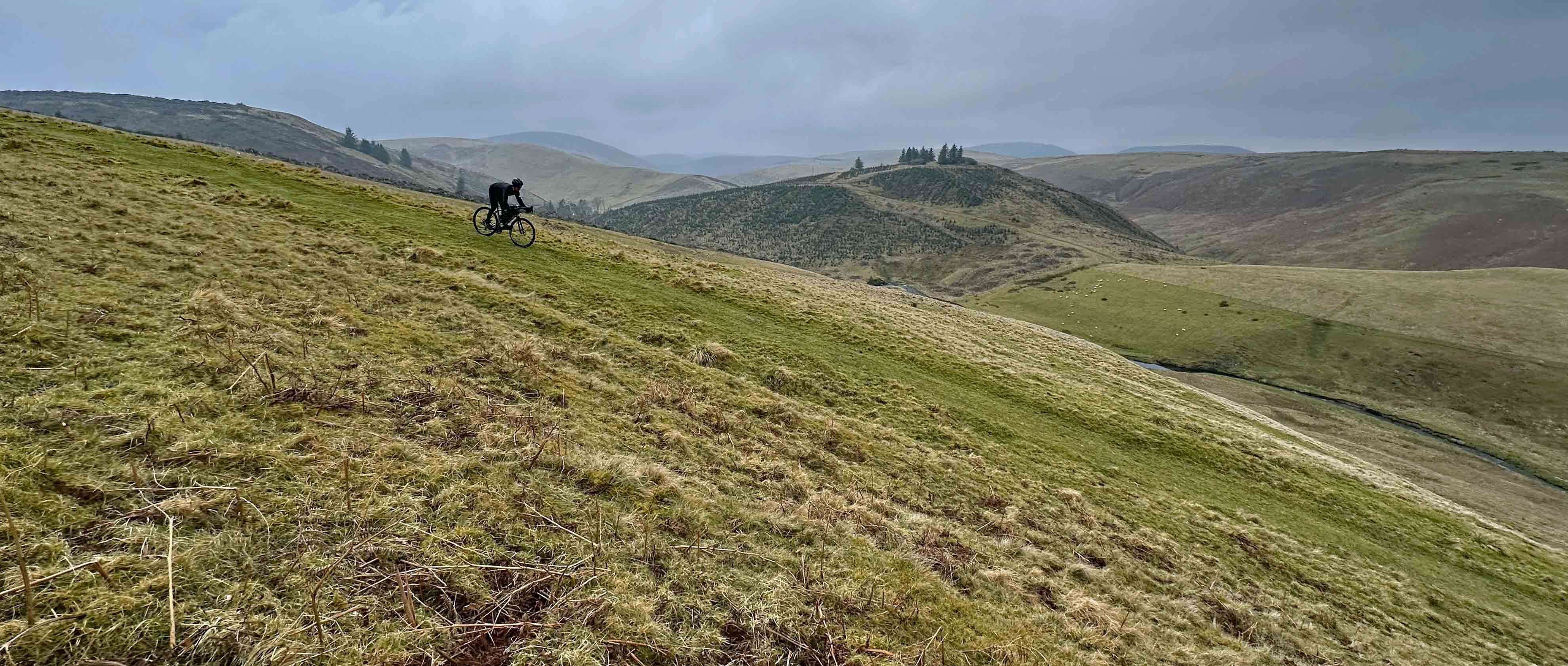
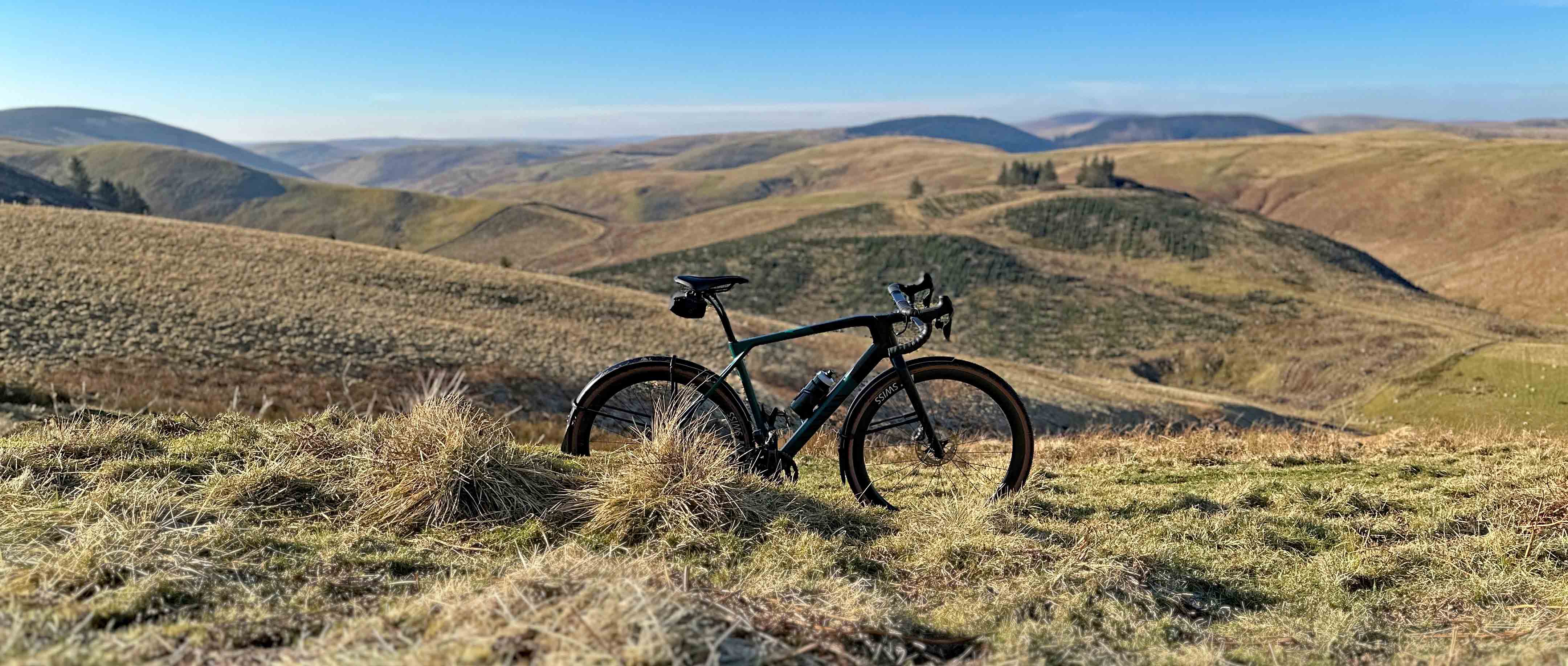
Although you might have to squint a little to appreciate it, there’s something vaguely Tuscan-looking about the landscape in places, particularly with small hilltop stanzas of trees like the ones in the background here. The difference of course is scale – the hills here climb up to 815m (the summit height of The Cheviot) and they stretch to the north, north-west and north-east as far as the eye can see. This landscape is vast and it’s something Rich had considered really carefully when planning the route. “I’m going to send out a mandatory kit list to participants and will be doing a kit check at the start and the finish. I don’t want to go as far as putting in obligatory overnight stops, but I want to make sure that riders are fully self-sufficient. If something goes wrong up here, help would be a long time coming.”
To get to the high point of our route, located at 529m altitude on the English/Scottish border, it had taken us around 90 minutes including some photo faffage. We calculated that the fastest riders would do it in around an hour, but this would depend significantly on the ground conditions and the prevailing weather. “Last August a local event organiser held an enduro MTB event not far from here and they had torrential rain and cold temperatures” Rich told me, which explained on his insistence on riders in his event being fully prepared. We were doing the test ride at the start of March which meant wet ground conditions, but we had been helped up the climb by an unusually strong wind coming in from the east. While this assistance was gratefully received, it would bite us firmly in the arse later in the ride when we had it as a block headwind in our faces.
“The descent from the border is properly long and starts off gently, but don’t be deceived as it gets steeper and more rugged pretty rapidly” Rich warned me as we set off into Scotland. Luckily the border post wasn’t manned on the day we were visiting, but if you happened to be there between the Bronze Age (around 2000 BC) right up the post-medieval period (after 1485 AD) then you may well have encountered everything from cattle being driven to market to Border Reivers crossing the border in search of bounty. We had nothing but a few fast-moving rabbits for company on our descent. Not that we had much time to spend looking for wildlife – the recent super wet weather had carved big ruts into one particular section of the descent and ratcheted up the technical factor significantly.
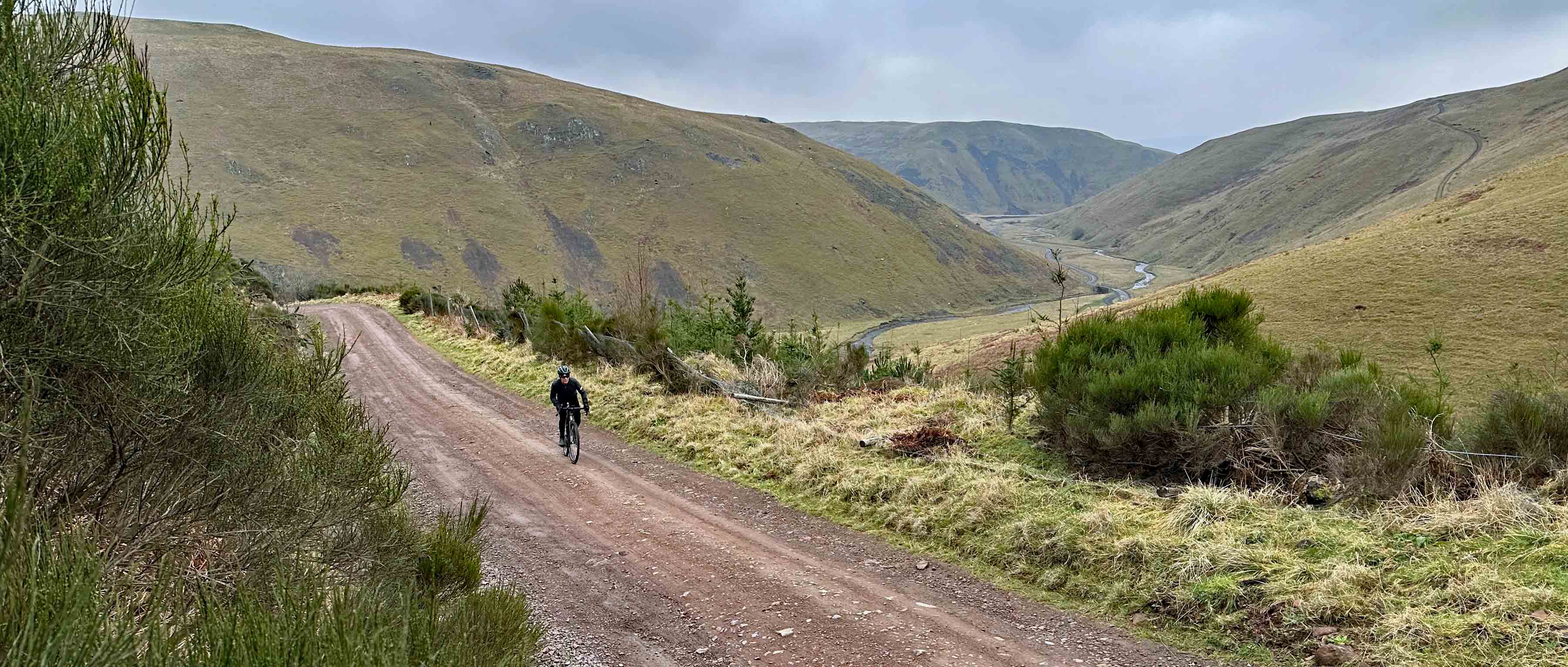
The steep, rutted section was short-lived however and we were soon onto a screamingly fast (but greasy) grass track. It was here that my wider 2.25” MTB tyres gave me an edge over Rich’s 35mm CX boots and I managed to open a small gap on him. There were sections where my bike was rapidly tracking sideways as I descended. Luckily, I managed to keep it rubber-side down, but it certainly gave us both a good spike of endorphins. After around 5 km of descending, we reached the end of the offroad trail and joined a narrow undulating paved road. Our route took us initially north-west and a combination of traffic-free tarmac with good sightlines and a screaming tailwind meant we made super good time, but I knew this was too good to last. As we rolled into the ancient settlement of Kirk Yetholm, where Rich knew of a perfect roadside water fill-up point, our route started to turn inexorably into the wind and before we knew it, our fast-rolling descent turned into more of a challenge. Grippy tarmac, rolling terrain and a brutal headwind made the section up to lunch significantly harder work than it should have been, although the great scenery helped take our minds off the pain in our legs somewhat.
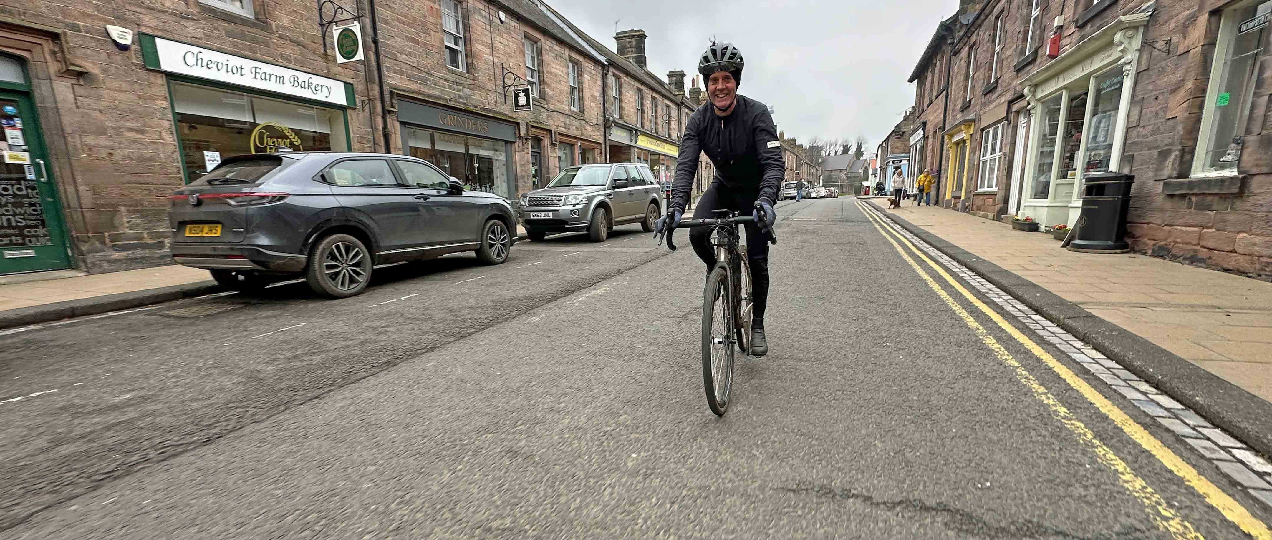
Lunch had been scheduled for the small market town of Wooler, home to an impressive range of cafes. With tired legs and cold bodies, we gladly took refuge inside and swapped energy bars for steaming plates of food. From Wooler onwards we were back onto my mental map again, but we deviated off from the route which participants in The Land Between will take. Their route will head across to the east coast from Wooler, where a series of bridleways, cyclepaths, minor roads, sections of singletrack and gravel tracks will see riders head south as far as the River Tyne.
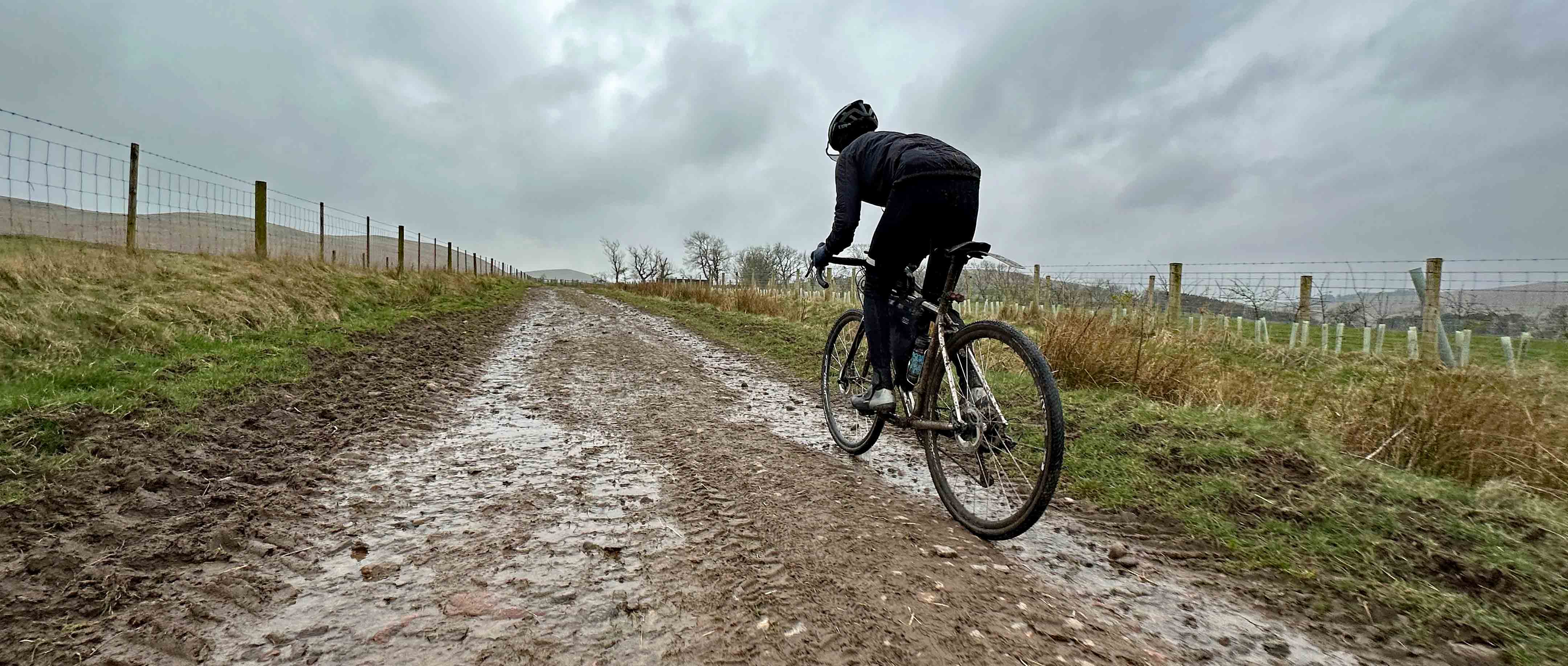
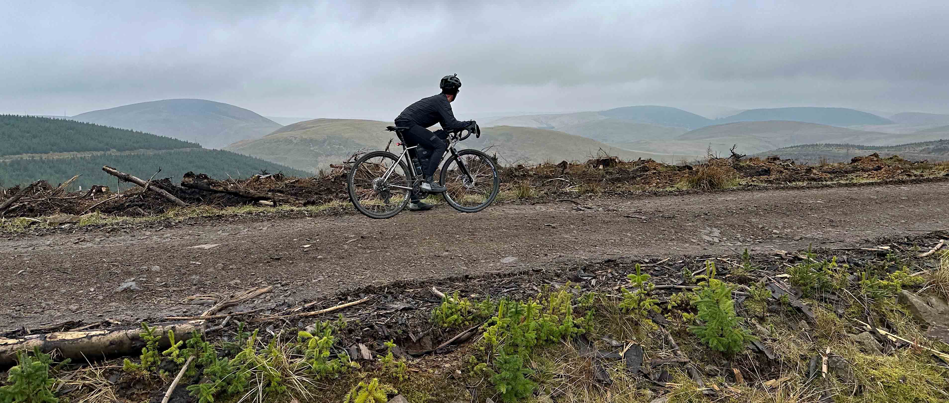
We on the other hand were doing a circular route, so we picked up the Sandstone Way long-distance trail, which Rich and I both knew well. Using a mix of sections of the Sandstone Way route and minor backroads we wiggled our way back towards the start. Unfortunately, the route had a killer sting in the tail though thanks to a combination of wet weather and bad luck. As we headed further south and west, we managed to turn the wind to our advantage again, but the trail conditions in places were a hideous treacly consistency thanks to some heavy farm traffic and the naturally clay-rich soils. On the long climb out of the Ingram Valley Rich’s superior fitness and ability to convert lunch into leg power really became obvious and try as I might, I couldn’t come anywhere near holding his wheel. As the gradient steepened, it felt like the mud deepened, so there was plenty of teeth-gritting and leg-willing going on to try and get my tired body to the top.
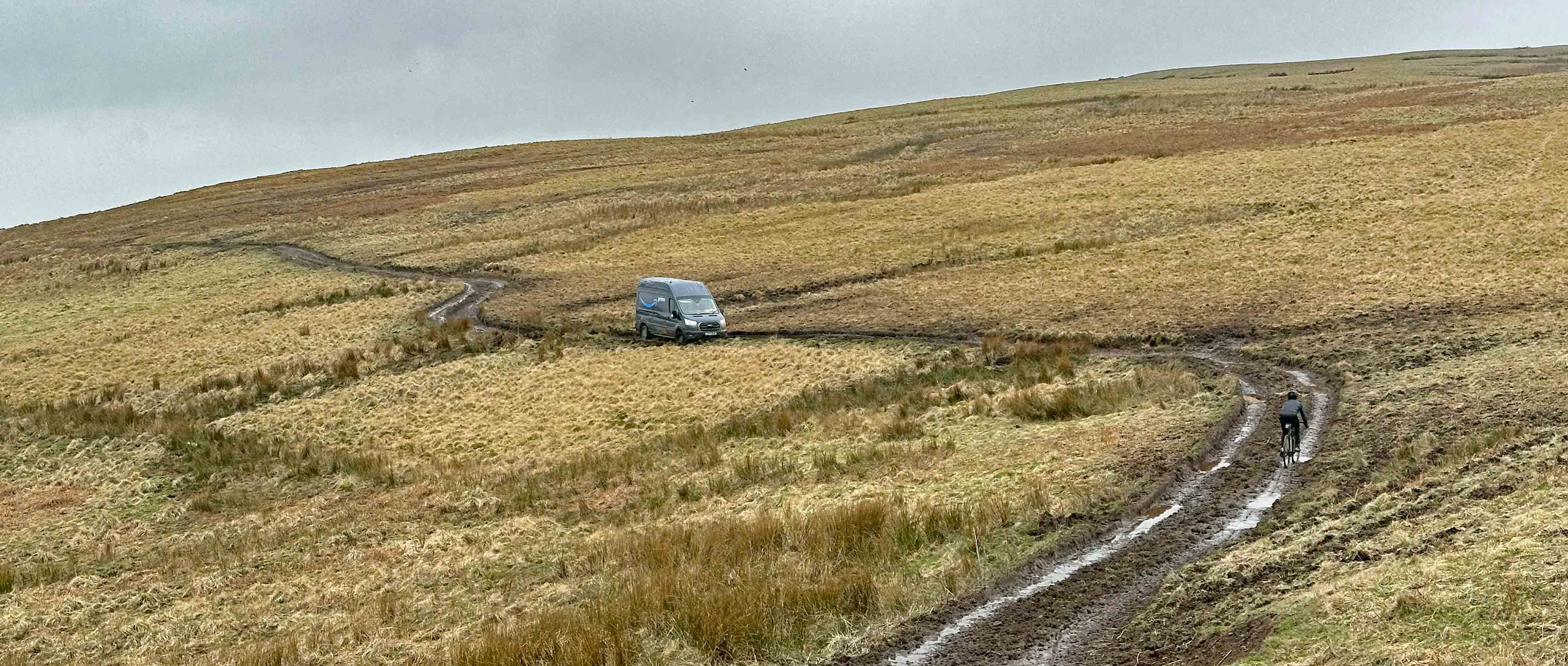
As we reached the summit, an interesting sight lay in front of us. Initially, I assumed it was a hypoxia-driven mirage, but it turned out that some poor unfortunate courier driver had mistaken our route over Whether Hill and Cochrane Pike as an appropriate shortcut for his Transit van. As we got closer to where he was sitting it was obvious that he was in for a long wait for help – both his front wheels were buried in mud and it looked as though he had grounded the underside of the van for good measure.
Rich and I considered offering some help to push him out, but we soon realised he would need something with significantly more oomph than a pair of gravel cyclists to remove him from his predicament. The driver was on the phone as we passed and made a slightly sheepish-looking face at us. He obviously possessed exceptionally good driving skills, as to get a two wheel drive van as far as he had on a track which the majority of 4x4 owners would have baulked at, was impressive if not somewhat deluded. “Hello. Is that the emergency services? Could you send me a helicopter rescue please as I’ve got my van stuck in a bog on top of a Northumbrian hillside….”
At the base of the descent Rich and I went our separate ways. Despite me offering to give him a lift home, he was adamant that he wanted to ride. When I compared our post-ride stats the next day he had ridden exactly double the distance I had managed and climbed 1000m more than me to boot. Guess that’s why he’s a champion ultra-endurance rider and I’m a desk jockey for my job!
The final section of my ride back to the start/finish was a mix of broken tarmac, farm track and gravel road, much of which was saturated in water and pretty greasy in sections too. It made me think about what bike I would choose to use if I was going to take part in The Land Between. The route will include a dramatic range of surfaces and terrains and my conclusion was that whatever bike you chose would be somewhat of a compromise at certain points. For our day ride, I was super glad of the extra cushioning and grip from the big tyres on my #monstercross bike (not to mention the super low gears for the long climbs), but Rich’s light and nimble CX-inspired set-up paid dividends on the road sections and the smoother sections of trail.
From the section of the route that Rich and I experienced on our reccie, plus the other parts that I knew already, anyone who takes on the challenge of The Land Between will be in for a treat no matter what type of bike you choose. When the weather is good, as it had been a few days before our reccie, the scenery is spectacular. Once you add in an incredibly varied route, some really novel sights to experience along the way and a friendly welcome by the staff at the pub where the event starts and finishes, it should definitely be an event to consider adding to your bucket list this year.
You can find out more details about the event here.